First, let me drop some do & don’t nuggets of wisdom on you about this trek:
Don’t fool yourself into thinking you can get away with wearing hiking sandals. I tried; you can’t. I loathe hiking boots, but you need very sturdy ones that offer fantastic ankle support. I learnt this within about one hour.
Do prepare to be amazed at the amount of ancient ruins you’ll stumble across (sometimes literally) while walking. It’s truly astonishing.
Don’t even bother to attempt this trek in September, no matter what you read. We tried the first two weeks of September and it. was. grueling. More on that to come. Were I to go again (and I may well do) I will go in or close to April.
Do get in and out of Tekirova as quickly as you can. It’s just awful, I’m sorry.
Don’t expect a gentle stroll through pastoral fields with plentiful shade. Unless your idea of pastoral fields are narrow rock-strewn walking paths between and over boulders, lined with sharp plants, more sharp rocks and minimal shade. Then yes, there are loads of pastoral fields.
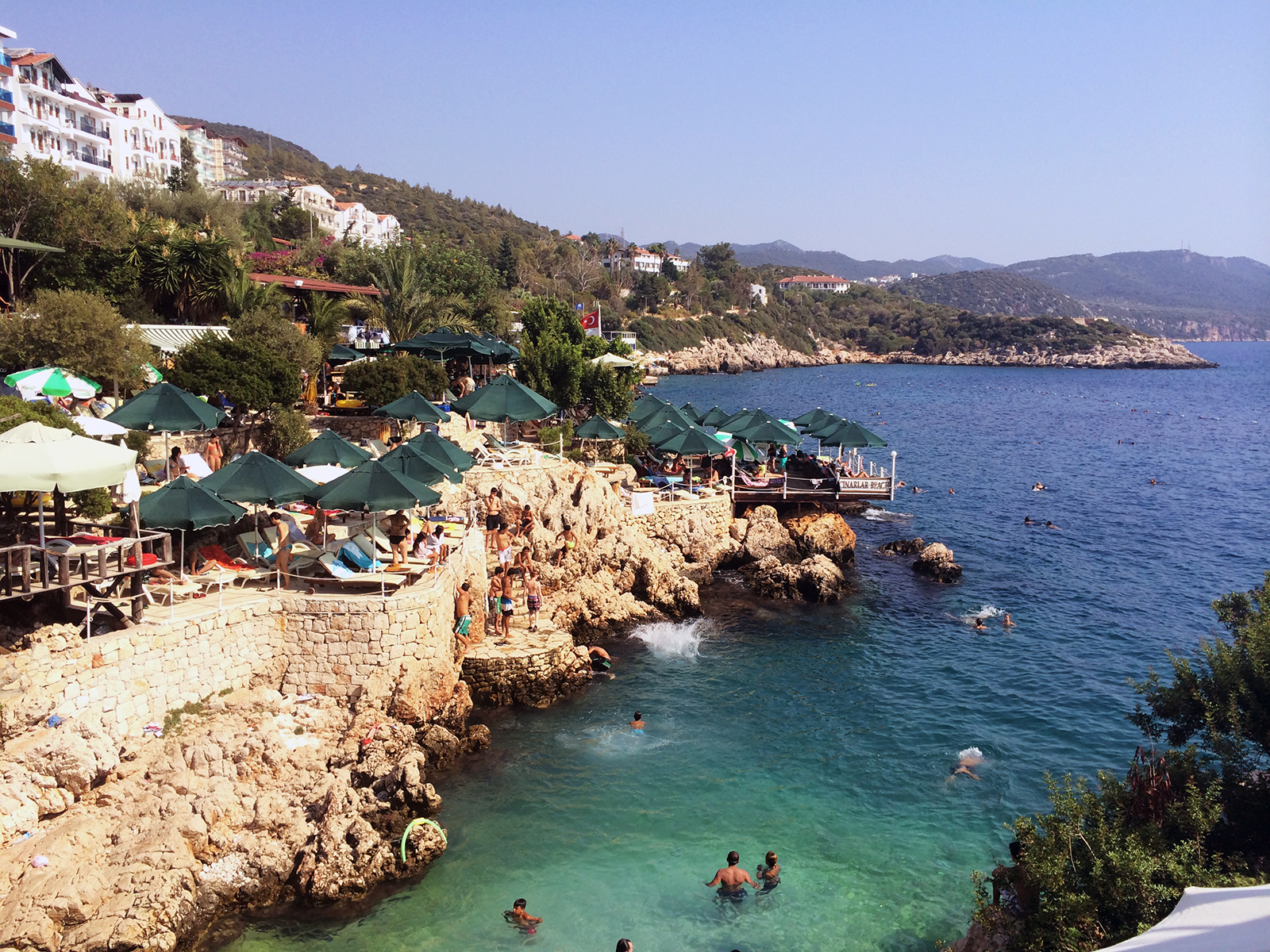 Kas’ seaside cafes and lounging decks
It’s worth bearing in mind that I only attempted the Kas-Phaselis portion of the trek, which is most of the eastern half of it. There’s another 250km or more west of Kas that I can’t comment on as a 500km trek was more than we could bite off by far in a two week time period (although one set of trekkers told me it was also very rocky and strenuous).

KAS-UFAKDIR
Arriving in Kas at the literal crack of dawn, we spent the first day picking up camping supplies and exploring the seaside town’s little street of coffee shops, restaurants (try excellent Ikbal for great manti, and apparently a great slow-cooked leg of lamb – which, sadly, was sold out by the time I arrived for dinner) and thinking, “hm… it certainly is a bit hotter than we were expecting”. Despite its Mediterranean location, don’t arrive here expecting sprawling beaches; hotels have stone beach terraces lining the cliffside with loungers and a platform to enter the water from. There was one small beach, and when I say small, I mean it – it was about 15 feet long. The sunset is predictably great, and my favorite spot to watch it from with a sundowner was a small rooftop cafe (not far from Ikbal) with a name I’ve forgotten, but whose signage features Le Chat Noir, which is easy enough to find.
 where we entered the path, which was misleadingly gentle and clear
We set out for the first leg of the walk early the next morning, hoping to get about 14km in that day, ending atop a mountain near a village called Bogazcik. We had no idea how high our hopes were.
Within about an hour or so, I realized sandals were not an option. I wasn’t pleased to have to put on my hiking boots, but as they were large and heavy, it was a relief to remove them from my rucksack. In that space of time, we also realized, “wow, it is really, really hot”. Moving on anyway. With the heavy sacks the heat got consistently worse. We made very poor time, scrambling over boulders and very narrow, rocky paths lined with thorny things, up and down hills, with the sun blazing down on you almost all of the time – the Med’s low scrubs don’t offer much in the way of shade – and it wasn’t long before the realization set in that there was no way we were going to make it as far as we had intended that day. After struggling to arrive at a small beach with a guest house and camp site in Ufakdir, a mere 7km from Kas, seven hours after we had set out, it was clear the trek wasn’t going to go as planned. Not in this heat with those heavy rucksacks.

On the bright side, Ufakdir was lovely (as was the walk’s scenery – particularly clinging to a cliffside with a rope only to find an incredible Lycian tomb carved right into the the cliff wall around the corner from the path). The brothers running the guesthouse and restaurant were fantastic company and cooked up an incredibly fresh fish dinner. The bay was cool and hugely refreshing on the feet after the walking and we even glimpsed some sea turtles lolling about in the water. If you have the chance to get there – it’s accessible from a small dirt road and boats were arriving with people on day trips – I’d recommend it.

UFAKDIR-SOME BEACH AT FOOT OF MOUNTAIN-KAS
We decided to spend the night in our tent instead of a room in the guesthouse. It was miserable. The heat was unbearable, as the waterproof tent didn’t have great ventilation, and we were bombarded by mosquitoes when we tried to open a vent to get a breeze in and woke up in a layer of sweat and bug bites. By this time, we had admitted that it was entirely likely that we weren’t going to be able to continue on the trek in our intended format. But we were giving it one more try anyway.
 where we ended the trek, at some beach at the foot of some mountain
It didn’t last long. We left very early in the morning, but it wasn’t long before the sun reached the top of the dirt road we were walking up, blazing down on us is all its intensity directly in front of our faces. Knowing this would likely be the easiest part of the day’s walk (midday heat was still long off, we were on a dirt road instead of a boulder- and thorn-strewn path) I sort of lost it briefly. Pulling myself together, we continued on, shortly making it to the proper path, which was, as predicted, covered in boulders in and thorny bushes. And no shade. After struggling for a bit we decided we just couldn’t go on, and a couple hours later made it to a very relaxing beach – near the base of the mountain we had hoped to make it up the day before – where we had the chance to cool down before having a taxi collect us and bring us back to Kas (the beach had a surprise and very welcome new dirt road that we weren’t expecting but quickly made use of). We briefly considered relaxing there for the rest of the day and camping overnight on the beach, but after the previous night’s rather unpleasant tent experience, it was probably best to not.
UCAGIZ/KEKOVA
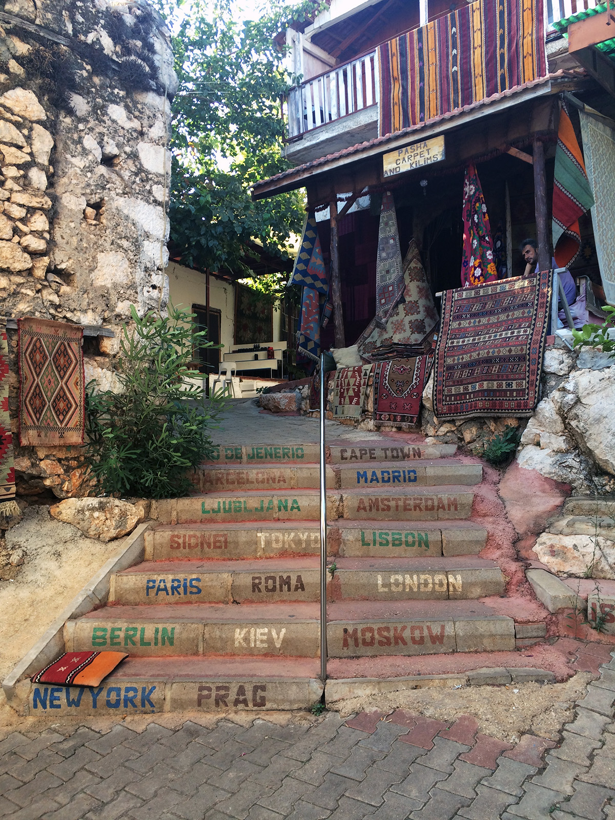 steps to a carpet shop in Ucagiz
After spending an air conditioned night in Kas, we decided to change the format of the trek and base ourselves out of various towns along the route, taking on day treks along the Lycian Way where we could leave our heavy bags behind in pansiyons. Hopping into a taxi, we made our way to the much smaller seaside village of Ucagiz, where we should have arrived at the end of our second day of walking. But clearly didn’t. This ended up being one of our favorite stops of the trip thanks to its tranquillity, friendly residents and the plethora of activities which were available from the town. There are also some great shops filled with beautiful Turkish carpets (both modern and antique), where we picked up a great woven and embroidered kilim rug in warm tones for the living room.
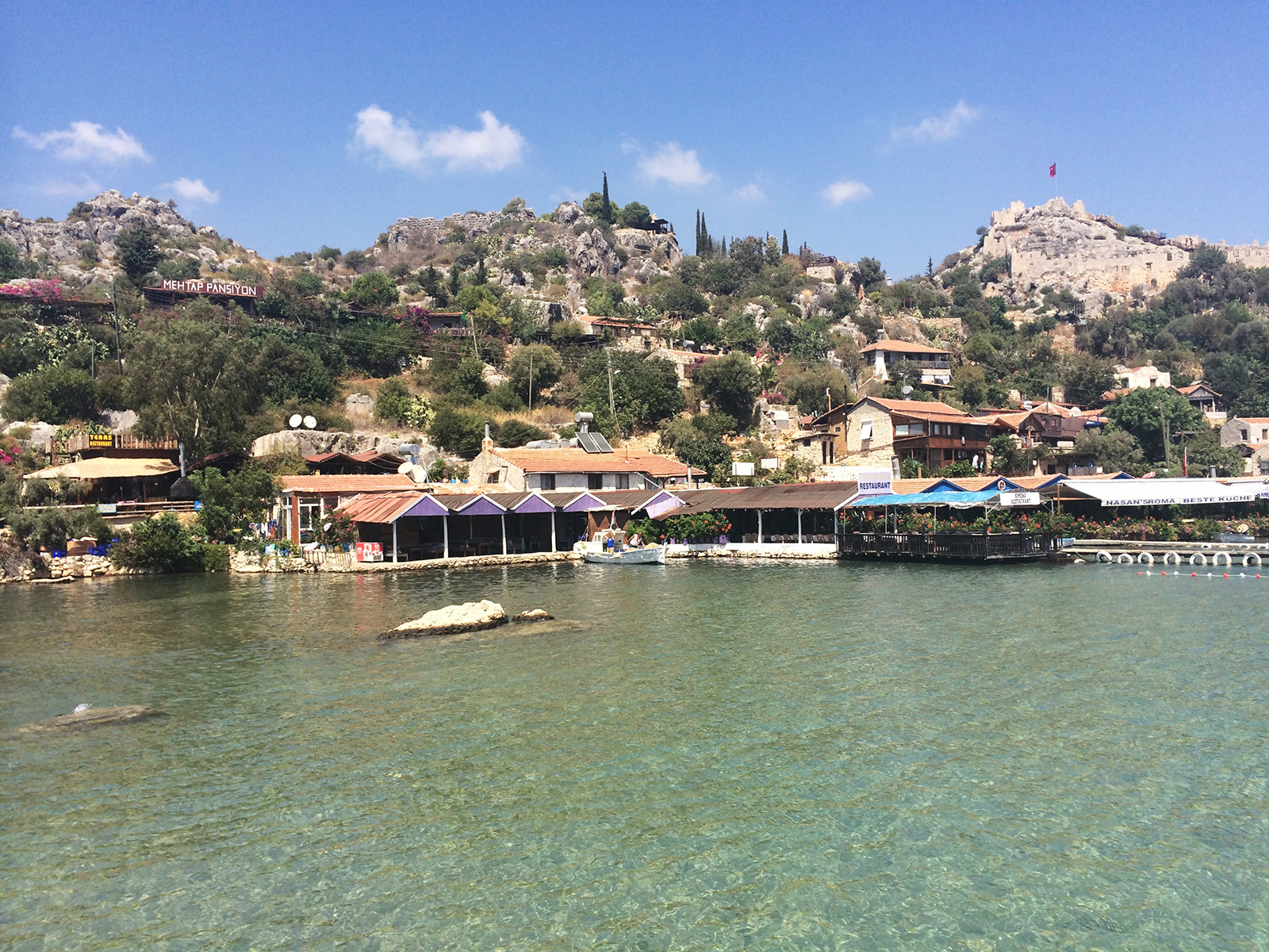 Kalekoy/Simena, with the castle ruins on the upper right
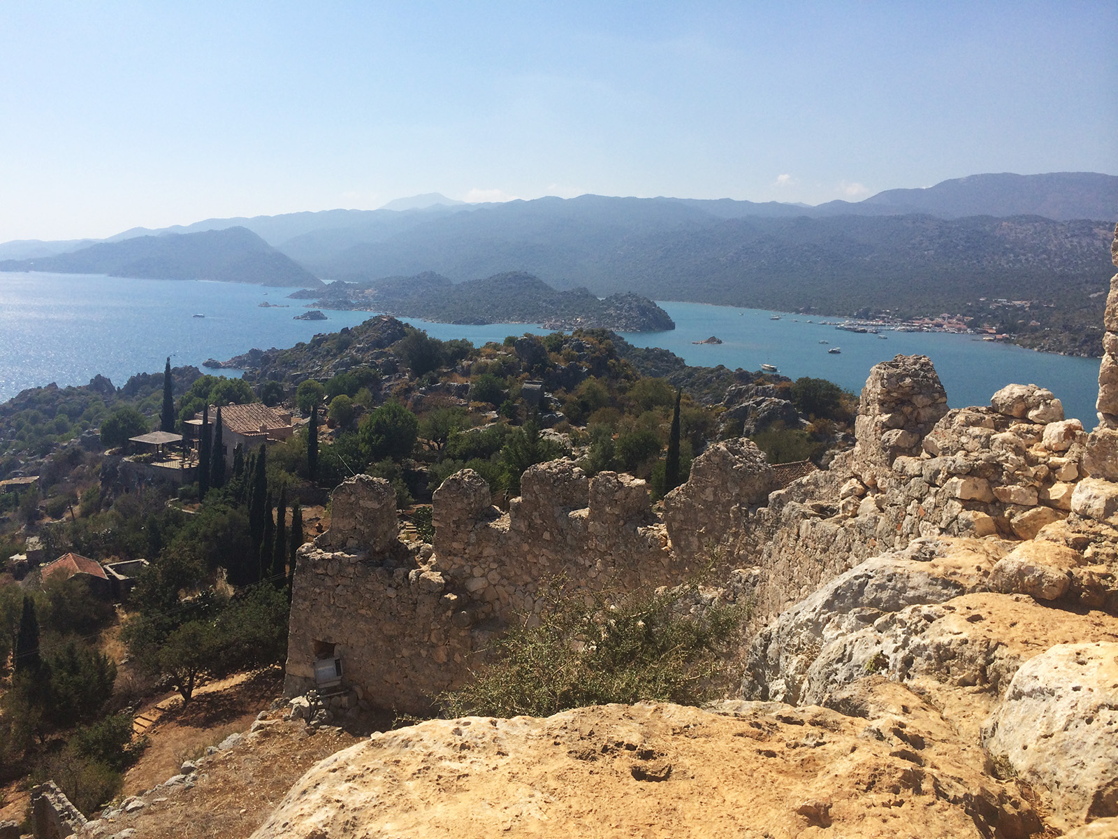 view from Kalekoy’s castle, with little Ucagiz in the background
On the first day, a boat was arranged to take us a short way away to the neighboring town of Simena/Kalekoy, where we could grab some lunch, explore some castle ruins (“Kalekoy” means “castle’s village” in Turkish) and then stroll back onto the Lycian Way for a short walk back to Ucagiz. Simena was very picturesque with its pansiyons and restaurants clinging to the hillside, which was topped by a fantastic little castle, and some sunken tombs just offshore which you could swim around (and I did). I didn’t think people were as friendly there as Ucagiz and it attracts a lot of tour boats dropping visitors off for lunch during their Kekova day trips, but it’s definitely worth checking out, if even briefly. The walk back to Ucagiz was only a few kilometers, but without our full rucksacks, we made it in just about an hour – much better than the kilometer-per-hour time we were making the previous two days.

This area is best known for Kekova, an island just offshore from Ucagiz and Simena whose city sunk into the Mediterranean in the 2nd century AD after a series of earthquakes – you can still see the sunken ruins in the clear water from any number of boat trips that can be booked from the nearby towns. It’s easy to spend a day doing this, pulling into little bays with coral, fish and ruins and diving off the back of your gulet (a traditional Turkish boat) to explore it all.
 sunrise over Ucagiz’s marina, on the start towards Aperlae
 tomb and building ruins at Aperlae
Ready to spend a day on the trail again, we revisited the Lycian Way to hike to the ruins of Aperlae and back again, about 15km all told. Carrying only a small rucksack filled with water, lunch and a few other necessities, the walking was significantly easier even though the route was just about as strenuous as it had been when we first set out. One of my favorite walks of the trip, the trail followed the coastline before heading inland and up a hill to large pastures with shaggy goats and cows, before making its way back down to the coast where another brief walk along the shore soon brought us to Aperlae’s ruins. This site of yet another ancient coastal city that partially sunk into the sea after earthquakes is remarkable in that it’s not yet been excavated (and there’s no plan to, because it’s only accessible by foot or boat, and Turkey has too many other sites to focus on) but structures are still fairly clear to identify. Bits of pottery are scattered all over the terraced hillside, when taking a dip in the water you step over a sunken harbour and warehouse that held shellfish which were used to create dyes, which were exported, and directly on the waterline you’ll walk through old bathhouses (if you’re following the Lycian Way path, it goes right through the building, which is incredible). So, as one does, we set up for the afternoon right in this ancient bathhouse to picnic, rest and dip into the water from.
 the Lycian Way path goes directly through Aperlae’s bathhouse ruins
On our final day in Ucagiz, we made our way to the small city of Demre to check out the old harbor of Andriake (but failed, as it seemed to us, after much walking around, simply inaccessible); the fairly impressive hillside tombs and remarkably in-tact amphitheater of Myra, which lies on the Lycian Way route; and the Byzantine Saint Nicholas Church (yes, the real Santa Claus was the bishop of Myra and probably never saw reindeer or Arctic winter weather), which was packed with tourists purchasing icons and slapping them again the protective wall between themselves and St Nic’s tomb, I suppose to bless them? I don’t know. I did find it fairly fascinating, though (I had no idea people took St Nicholas so seriously) and the church itself was beautiful.
 tombs of Myra, carved into the hillside
 frescoes in the Church of Saint Nicholas
CIRALI/OLYMPOS
If we were walking, it would have taken us three days of mountain trekking, without coming across any other villages or towns, before we would have made it to Cirali. But we weren’t walking anymore, so it was only about two hours on a small bus. I really liked Cirali – it was tranquil, a bit rustic and had a touch of the feel of beach towns in Asia with a number of no fuss guesthouses and open-air bars and restaurants on the beach.
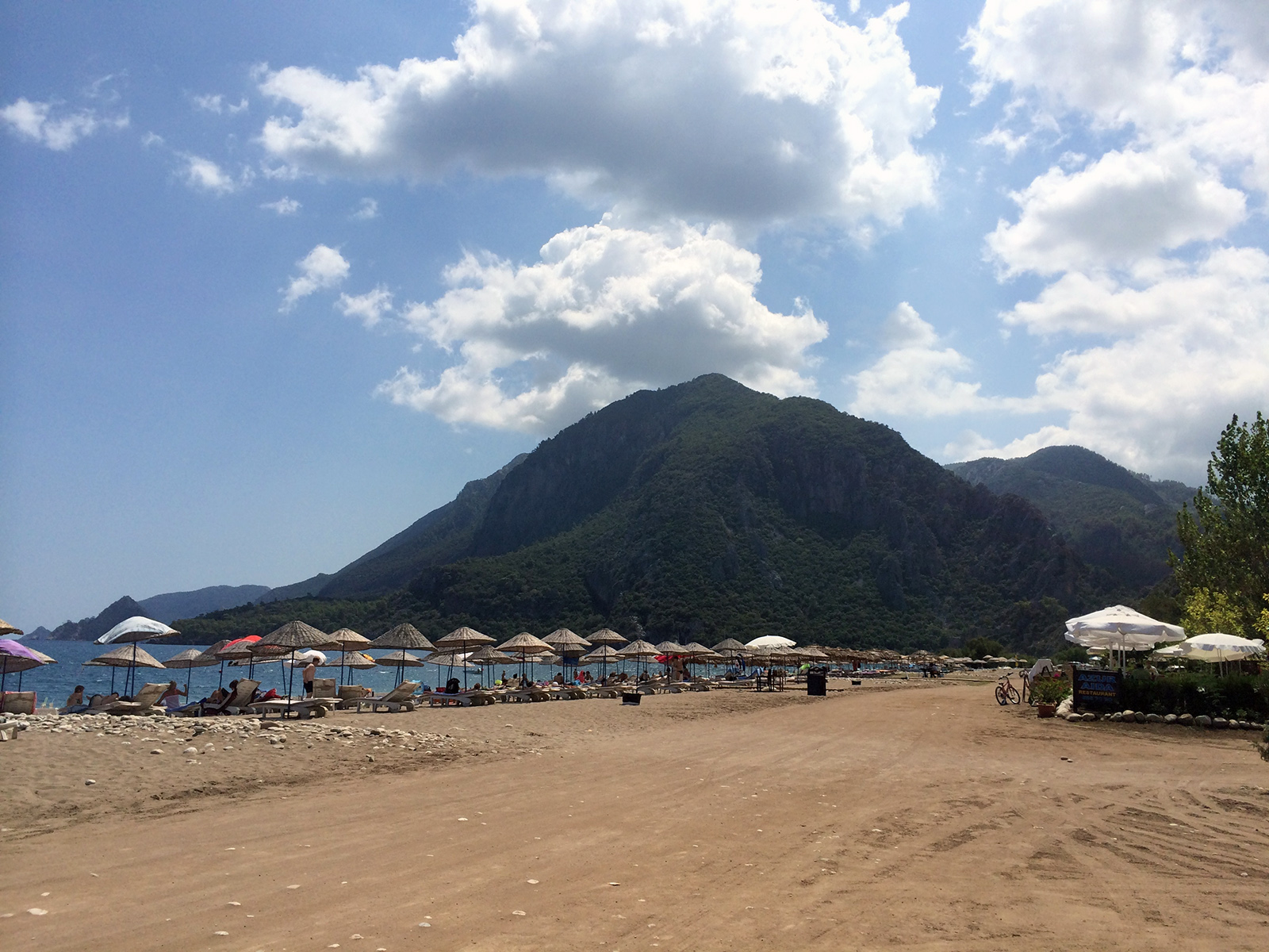 beach at Cirali and a bit of Mount Olympos
From here, it was an easy walk (well, actually, not so easy for me, as I had just eaten a massive Turkish pita with about five pounds of cheese and sausage on it) to the flaming site of Mount Chimaera (Yanartas). On a hillside just above the beach town is, according to legend, the spot where Bellerophon and Pegasus slew the fire-breathing Chimaera and buried it in the ground. Once buried, the beast’s body continued to emanate flames, which now eternally burn above ground. It’s pretty remarkable, to be fair, but the flames are due less to a mythical beast than they are to hydrogen and methane gas emissions.

The main event for our Cirali stay was to head back onto the Lycian Way and hike across Mount Olympos, and into yet another cache of ruins. Arranging a car at dawn, we got dropped off at the far side of the mountain and set off walking the 15km back over it to Cirali. Not at all as tough as I was worried the mountain hike would be, it was a pleasant respite from all of the other walking we had done in the region so far: the path was free of boulders and thorny things, there were plenty of tall, leafy trees providing shade and it was all nice and verdant. We were hoping to have lunch at the summit, but we reached it much more quickly than anticipated and actually made it all the way back down again before lunch time.

At the base of the mountain on the Cirali side you’ll find the fairly expansive ruins of Olympos running along the beach and up the base of the mountain a bit. There’s a nice little amphitheatre, a promenade and, of course tombs – the Lycian Way is absolutely littered with tombs. You can continue on the Lycian Way and through more ruins to get the rest of the way back to Cirali, or walk along the beach, where you’ll still see even more ruins, and possibly some sea turtle nests (so tread carefully).
 on of Olympos’ roads, running parallel along an inlet towards the sea
TEKIROVA
Our next stop was Tekirova. The walk from Cirali to Tekirova was possible, but we would have had to both carry our full rucksacks, something I still wasn’t keen to do, especially seeing that this section of the walk had a bunch of up and down and was back to scrub landscape. So, I went with most of our supplies on a taxi to Tekirova, while the boyfriend trekked the 18km or whatever is was from point A to B.
On the one hand, I’m glad I didn’t do the walk. It apparently veered off course much further than our GPS and maps had said it would, and on top of that it downpoured off and on throughout the morning and afternoon.
On the other hand, Tekirova was a dump that I loathed pretty much the moment I got dropped off in it and I wanted to be anywhere but there. It’s basically a Russian resort town (everything was in Russian, and a shop owner told me that Turks kept a wide berth from the place) and filled with fur boutiques, knock-off designer clothes and a line of 3-4 star all-inclusive resorts pumping out crap dance music that you could hear from a mile away (barely an exaggeration).
I have no photos from Tekirova because I want it purged from my memory.
 in the morning, the shores of Phaselis are peaceful
From here, the Lycian Way continues on for a handful of kilometers to the ancient city Phaselis. It’s a pretty easy walk, although before you get fully out of Tekirova you’re subject to walking through mudfields filled with trash apparently dumped there by the resorts, so that’s nice. Shortly before making it to Phaselis, you’ll walk through a farm/retreat called Sundance Camp and I would highly recommend staying there rather than Tekirova, if you need to stay in the area and can. I didn’t have the chance to stay there, but it looked nice and peaceful.

Phaselis is yet another city of ruins – great aqueduct, amphitheater, impressive ancient main road leading through the city. I mean, I just don’t know what to say any more about all of these sites. They’re all amazing and well-worth seeing, but to write about (without going into a 10,000 word epic) they’re all a bit same-y. I would recommend visiting Phaselis as early in the day as possible. We arrived there around midmorning from our walk, and thought it was a really tranquil respite from Tekirova. By the time we left, the dozen or so party boats (some with huge, gaudy skulls on them in an attempt to make them look like tacky pirate ships) that had loudly moored in the bay to drop of tourists on day-trips from Tekirova, Antalya and Kemer had broken the peace with more no-so-great dance and pop music playing far too loudly.
 by late morning, a steady stream of day-trip party boats pollute Phaselis’ bay with blasting garbage music
Phaseslis was where we had always intended to end the trek (it does continue a bit further inland towards Antalya, however, before it officially ends), figuring it would take us about nine days to walk it all. Though we didn’t properly trek it as intended, all this still took us about nine days.
And next? Off to explore Antalya for a few days.
[ see more pics from the Lycian Way trekking route here ]
[ see more pics from towns and ancient sites around Lycia here ]

I’ve always wanted to visit Kas. It’s very similar to the Croatian coast. Incredibly!